Climatological
Modeling of Precipitation in the Greater Vancouver Regional District (GVRD)
Precipitation
within the GVRD was modeled based on over a decade of historical precipitation
data for 43 stations. Several interpolation models were applied and compared.
The end result was a set of precipitation surfaces for monthly and annual precipitation,
with the possible application to a simple forecasting function.
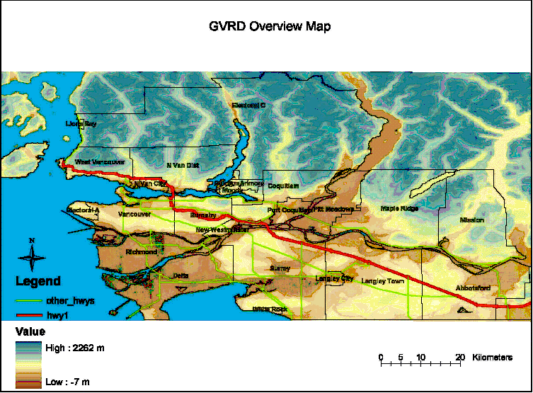
Map
of the GVRD highlighting relief and municipal boundaries.s
A
more detailed project overview is outlined in the Executive
Summary.