
| |
Groundwater Modeling System (GMS) version 4 is a comprehensive graphical user environment for performing groundwater simulations. It houses an array of modeling tools and ten modules; namely Triangulated Irregular Networks (TINs), Borehole for edit and display of borehole data, Solid for constructing 3D models of stratigraphy, 2D and 3D Scatter points for 2D and 3D geostatistics respectively and Map for building conceptual models using GIS objects. The other modules are 2D and 3D meshes and 2D and 3D grids. The task of this project focused on Borehole, TIN, 2D and 3D modules in developing 3D well-log data representations to analyze the two classification systems. In this project, our responsibility was to model borehole data classified using the two classification systems; GSC and BC rules and report the similarities and discrepancies in their standardization process. Thus, results of borehole data in GMS should be used for a graphical model analysis of the two classification systems. GMS, like any other software application, has its own data format requirements and restriction on data structure. A brief outline of challenges encountered in this project specific to the use of GMS and well-log data are discussed below.
Data Heterogeneity
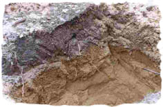
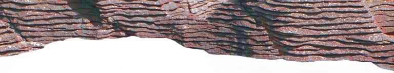
Based on the distributed nature of our well-log data, which exhibits subsurface material heterogeneity both within individual wells and neighboring wells, interpolation is difficult to perform in GMS, and cross sectioning between wells requires expert knowledge and study site experience. Interpolation to the same category or a material unit between separate wells poses a challenge because of the occurrence of specific material at different height locations within the same well and conflict in height of subsurface units. Thus, the ordering of geological units in each borehole affects the modelling process. For homogeneous occurrence and a consistent presence of material units in boreholes, interpolation is smooth and aids the visualization process.
Borehole Unit Restrictions
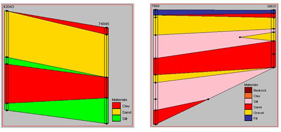
In satisfying uniform occurrence and consistent existence of material units in boreholes, another quantity to ascertain is the number of material units. The maximum number of subsurface categories or material units should be no more than five. Despite the high variability in our welllog data consequent to performing standardization, the data was reduced to five categories but the existence of disparities in height locations of corresponding subsurface units still exist. Please see examples below:
| |

Group Members:
Dawn Cambrin
Lisa Demeule
Gift Dumedah
Dylan Hoare
Kevin Simmonds

March 2004