
|
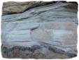
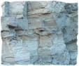
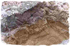
Subsurface modeling provides a means of understanding subsurface geologies, as well as a means of managing drinking water from groundwater sources such as aquifers, wells, and springs. When considering that in Canada about 6 million people rely on groundwater for domestic needs (Christopherson 2000) we can appreciate the importance of accurate subsurface data collection and representation. However, because subsurface lithologies are hidden below the earth's surface it is difficult and expensive to obtain samples.
In Canada , water well drillers are the primary source of data identifying subsurface geology (Schuurman 2002). Unfortunately, due to the variability in experience and education of the drillers, the well-log data varies considerably in its level of detail, with many soil deposits and rock formations being misrepresented, or numerous descriptions being given for one type. This has resulted in thousands of different lithological terms being used to describe the subsurface in British Columbia alone (Schuurman 2002) and in high variability in geological formation within a small study region. This figure, of course, far exceeds the actual variability in the geology of the subsurface.
In Canada each province maintains control of its groundwater and well-log data, with each using different data collection protocols and techniques. This has resulted in a semantic heterogeneity within and between provinces. Watersheds and groundwater systems like any other environmental phenomena do not respect political boundaries, often travelling across entire regions and provinces. In order to fully understand where groundwater is to be found and how to prevent abuse of known sources from pollution (which can spread over a great distance) and overconsumption, it is crucial that groundwater managers have a solid base of interoperable data to work with. When you consider that groundwater managers in British Columbia rely almost exclusively on well-log data submitted by private drillers (Schuurman 2002) who use their own subjective methods of classification it can be seen that modeling subsurface lithologies is, at this time, haphazard to say the least.
Knowing how important the issue of interoperability is the Ministry of Environment, Land and Parks (MELP) in Canada , along with other government agencies worldwide, standardization bodies such as the OpenGIS Consortium (OCG) and academics, are currently undertaking interoperability research. Regardless, Drs. Schuurman and Allen at Simon Fraser University (SFU), Vancouver , British Columbia , know full well that it will take many years for a constructive resolution to be agreed upon have developed an interim solution. This solution is a Visual Basic program called Lithological Data (LD) Builder.
Using well-log data (collected from the department of Earth Sciences at SFU) for the Grand Forks basin and Abbotsford areas, our team's task is to take this disparate collection of data and standardize it using two different classification systems in LD Builder namely; Geological Survey of Canada (GSC) and British Columbia (BC) rules. The resulting standardized borehole data is then represented in a modeling software called GroundwaterModeling System (GMS). The mandate of this project is to compare the results of these two classification systems and report on their respective methods of borehole data standardization in terms of similarities and differences and thus determine which system is most appropriate for modeling subsurface lithologies.
|

Group Members:
Dawn Cambrin
Lisa Demeule
Gift Dumedah
Dylan Hoare
Kevin Simmonds

March 2004